Our Research
With its focus on ‘marginal landscapes,’ CAPS aspires to develop a more inclusive approach towards the diversity of landscapes and their roles in connectivity and mobility networks in rural Greece from prehistory to present. CAPS intends to contribute to the re-evaluation and study of so-called ‘marginal landscapes’ in the Mediterranean and focuses on an endangered and topographically challenging region, Achaia Phthiotis, on the margins of the Thessalian plains in central Greece. CAPS employs established archaeological methods in pedestrian survey, but –because part of the region is difficult to access and is covered in shrub and trees- will also develop and use alternative survey strategies, such as remote sensing, to explore its archaeological potential. It will serve as a test area for similar regions with difficult access.
The focus of CAPS is the landscape around the 4th-2nd century BCE urban community at ‘Kastro’ previously researched as part of the KKAP project (link!). In this peripheral region, we intend to: study the potential and use of natural resources, the development of cultivation practices, pastoralist strategies and the evolution of transport routes/networks. Yet, rather than focusing on the—in temporal and spatial terms—narrow relationship between ‘Kastro’ and its landscape alone, we plan to study landscape from a broader and more dynamic perspective by emphasizing the interplay between environmental, geopolitical, cultural and social factors for the community/ies living in the Kallithea area through time.
We aim to deconstruct the concept of marginality that is currently is projected on this area. The longue durée approach will allow us to assess the dynamic roles of this area as a boundary zone, as a corridor landscape and as an area of centrality and belonging, in the history of Thessaly
Arable land in Achaia Phthiotis is limited, its valleys and mountains only allow for a strongly directed form of mobility. Connections between the coast and fertile Thessalian plains are few, posing interesting challenges for the study of this region.
Finally, the current remoteness of our area makes adequate archaeological supervision a challenge. As a result, it has fallen victim to looting, encroaching agricultural practices such as agroforestry (including deep ploughing), plans for the creation of an artificial lake and the extensive placement of solar panels. The project’s final aim is therefore to create a shared dataset that will enhance the region’s archaeological visibility facilitating better protection of its record.
Achaia Phthiotis was part of Thessaly’s so-called perioikoi, landscapes at higher elevations surrounding the fertile plains of the Thessalian lowlands. Its highly diverse topography comprises the Othrys mountains, areas of rolling hills, the river Enipeas, valleys with undulating streams and the coastal ‘Krokian’ plain. The focus of the project is the study of cultivated and uncultivated land in surrounding the Kastro at Kallithea, the 4th-2nd century BCE site which has been the focus of the previous project, KKAP. This remote landscape lay at a nexus of intensely travelled passageways; east-west routes connected coast and inland, while north-south pathways between the lowlands and mountains facilitated the seasonal trek of humans and animals between winter and summer pastures.
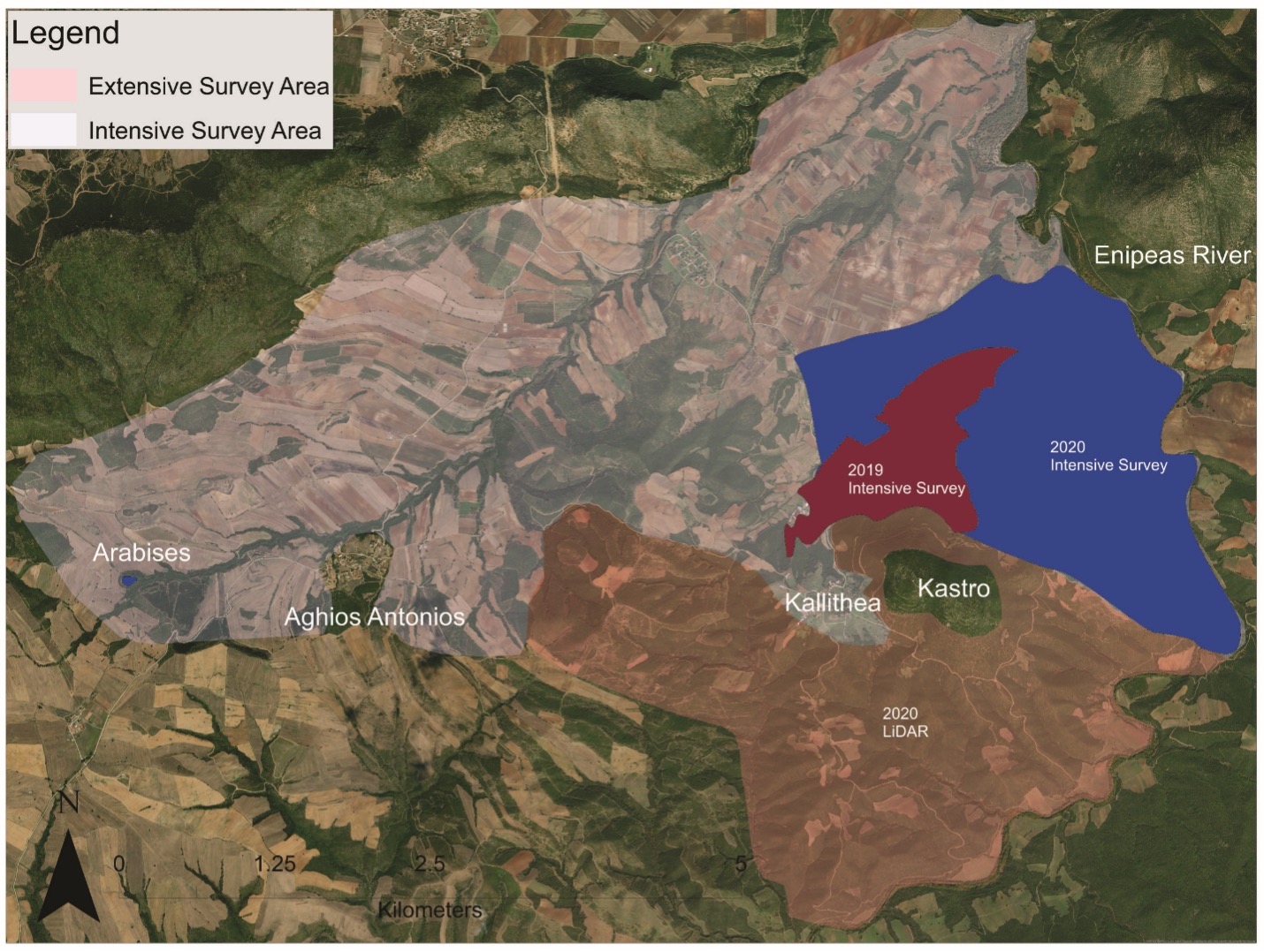
Our research area measures ca. 3000 hectares, is bounded by the river Enipeas in the south and east, and extends towards the Narthaki range in the north. It includes the area around the settlements Kallithea and Platanos and the valley of the Kotsilorrema stream around the village Aghios Antonios.
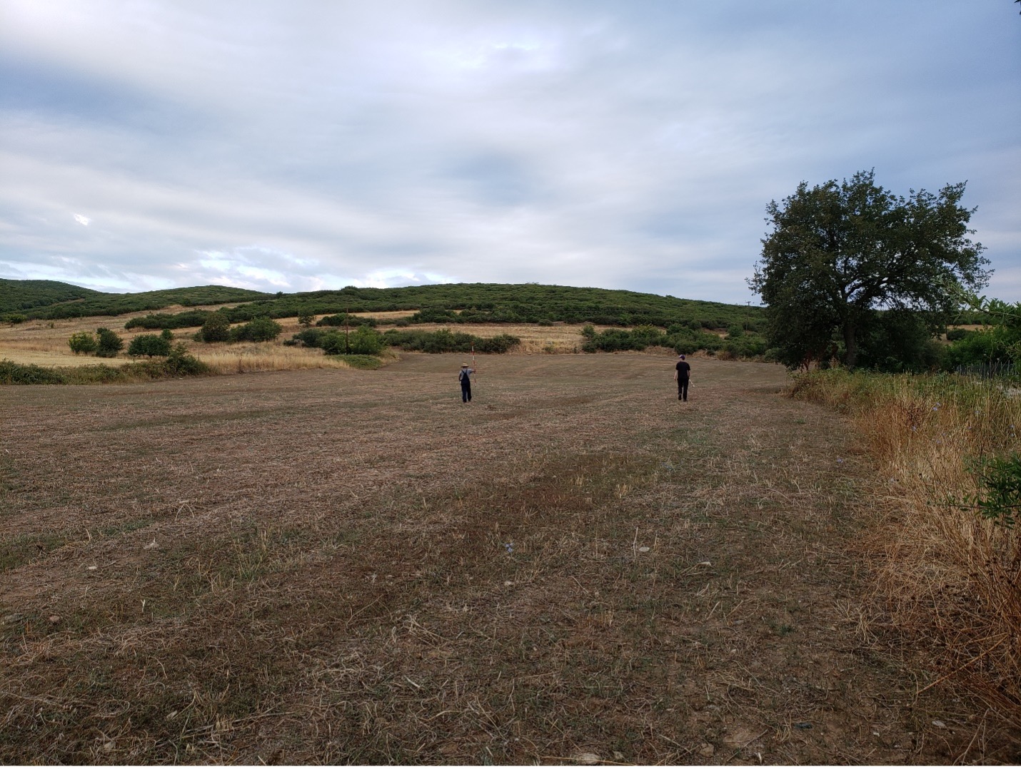
Most of the land is used for cultivation and grazing and we use established methods in pedestrian survey to cover this area. CAPS uses a total collection strategy. Recording was done on smartphones using the Survey123 app which is integrated with ArcGIS.
Yet, part of our survey area is covered in shrub and trees. CAPS employs a combination of remote sensing, inclusing LiDAR, hyperspectral imaging, and groundtruthing to study the archaeological remains.
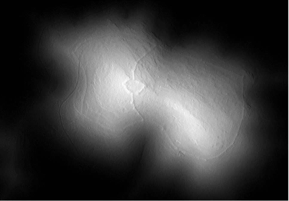
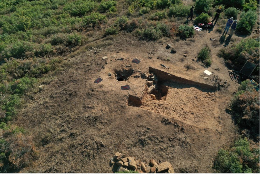
It has become clear that the landscape immediately surrounding the Kastro is occupied with architecture including fountain houses, extramural architecture, tholos tombs, and a necropolis with tile graves. Our team was able to map several features in this area, but the ones that stood out were the numerous tholos tombs belonging to the Early Iron Age. To facilitate the interpretation of the results of the remote sensing techniques, confirm dating, and potentially reconstructing this early funerary landscape, the team cleared the surface of two of the known looted tholos tombs, documenting them using our drone, cameras, and create 3D, DEM models and orthomosaics. One tomb was excavated.